| Name | Size/Acres | Max Depth/ft. | Maine Atlas Map # |
| Barrows Lake | 281 | 36 | 36 |
| Big/Little Greenland Lakes | 130 | 30 | 45 |
| Baskahegan Lake | 6,944 | 22 | 45 |
| Beddington Lake | 404 | 59 | 25 |
| Big Lake | 10,305 | 70 | 35,36 |
| Bog Lake | 826 | 46 | 26 |
| Boyden Lake | 1,702 | 34 | 37 |
| Cathance Lake | 2,905 | 75 | 36 |
| Clifford Lake | 954 | 50 | 35 |
| Crawford Lake | 1,677 | 27 | 36 |
| Crooked Brook Flowage | 1,645 | 20 | 45 |
| Drake Lake | 260 | 18 | 45 |
| East Musquash Lake | 806 | 62 | 45 |
| Farrow Lake | 224 | 76 | 45 |
| Fifth Machias Lake | 1,069 | 27 | 35 |
| First Chain Lake | 336 | 35 | 35 |
| Fourth Machias Lake | 1,539 | 26 | 35 |
| Gardner Lake | 3,886 | 56 | 26 |
| Grand Lake | 16,070 | 128 | 45,53 |
| Hadley Lake | 1,776 | 31 | 26 |
| Howard Lake | 527 | 50 | 37 |
| Indian Lake | 120 | 20 | 26 |
| Jackson Brook Lake | 731 | 20 | 45 |
| Keenes Lake | 115 | 37 | 37 |
| La Coute Lake | 137 | 11 | 46 |
| Lambert Lake | 605 | 60 | 46 |
| Little Cathance Lake | 140 | 17 | 36 |
| Little Tomah Lake | 147 | 20 | 45 |
| Long Lake | 698 | 28 | 26 |
| Love Lake | 672 | 40 | 36 |
| Lower Hot Brook Lake | 713 | 13 | 45 |
| Lower Oxbrook Lake | 365 | 30 | 35 |
| Marks Lake | 240 | 27 | 26 |
| Meddybemps Lake | 6,765 | 38 | 36 |
| Montegail Pond | 170 | 12 | 25 |
| Mopang Lake | 1,487 | 76 | 35 |
| Nash’s Lake | 627 | 56 | 37 |
| North Beaverdam Lake | 147 | 21 | 35 |
| Orange Lake | 234 | 24 | 26,27 |
| Patrick Lake | 275 | 32 | 26 |
| Peaked Mountain Pond | 227 | 48 | 25 |
| Pennamaquan Lake | 1,209 | 24 | 37 |
| Pleasant Lake | 339 | 36 | 36 |
| Pleasant Lake | 1,574 | 92 | 45 |
| Pleasant River Lake | 949 | 52 | 25 |
| Pocomoonshine Lake | 2,464 | 40 | 36 |
| Pocumcus Lake | 2,201 | 44 | 35 |
| Pug Lake | 198 | 39 | 35 |
| Rocky Lake | 1,555 | 37 | 26 |
| Rocky/Sunken Lakes | 1,126 | 33 | 26 |
| Round Lake | 558 | 14 | 36 |
| Round Lake | 352 | 25 | 26 |
| Round Pond | 205 | 26 | 25 |
| Schoodic Lake | 389 | 37 | 25 |
| Second Lake | 1,650 | 25 | 26 |
| Second & Third Lakes | 243 | 56 | 35 |
| Second Chain Lake | 589 | 30 | 35 |
| Second Machias Lake | 192 | 14 | 35 |
| Second Mopang Lake | 145 | 20 | 25 |
| Shaw Lake | 211 | 30 | 45 |
| South Beaverdam Lake | 160 | 40 | 35 |
| Southwest Pond | 138 | 34 | 25 |
| Spednik Lake | 17,219 | 54 | 45,46 |
| Spruce Mountain Lake | 448 | 43 | 25 |
| Sucker Lake | 256 | 32 | 45 |
| Third Chain Lake | 157 | 36 | 35 |
| Third Machias Lake | 2,778 | 35 | 35 |
| Upper Hot Brook Lake | 912 | 18 | 35 |
| Upper Oxbrook Lake | 442 | 18 | 35 |
| Wabassus Lake | 953 | 20 | 35 |
| West Grand Lake | 14,340 | 128 | 35 |
| West Musquash Lake | 1,613 | 108 | 35,45 |
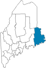
Washington County